Our story
The history of Cox Green
Cox Green is a place in its own right: older than the ribbon of houses along Church Street that now defines it, and never merely an extension of the villages around it.
How the settlement grew
Although Cox Green has much older origins, much of today’s roadside settlement developed after the Lynwick estate was broken up in 1922.
Plots on the western side of Church Street were developed first, with most occupied by the Second World War. Land associated with Dukes Farm on the eastern side was subsequently sold and developed in stages, followed by later infilling.
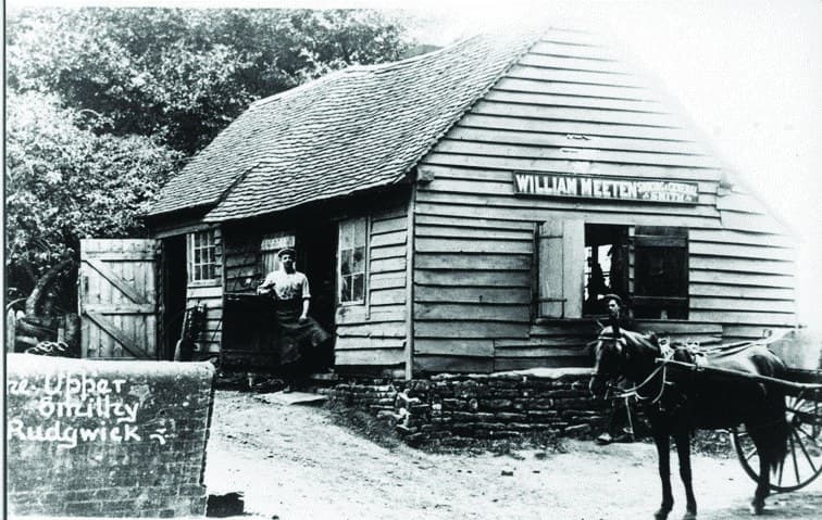
Historic accounts record a shop at Crouchers, a smithy and a builder’s yard at Oakfield. The unusually wide roadside verges may be remnants of the original “green” from which Cox Green takes its name.
Cox Green historically extended beyond the familiar ribbon of houses, including properties along Cox Green Road, now Baynards Lane, towards Baynards and on Hermongers Lane.
How the county boundary changed
During the late 1980s boundary review, the Commission proposed transferring 33 properties fronting Church Street from Surrey to West Sussex.
The Commission’s initial argument was that these properties used facilities on the West Sussex side and should be joined administratively with Rudgwick. Local opinion told a rather different, and more complicated, story.
Residents wrote to the Commission to say that they used Surrey facilities at Cranleigh and Ewhurst rather than Rudgwick’s, and that the proposed line would split Cox Green in two. Horsham District Council subsequently objected, while Rudgwick Parish Council changed its position and concluded that the transfer could create more problems than it solved.
The Commission nevertheless retained the proposed transfer of the 33 properties. Following objections, it removed the open land east of Church Street and two Hermongers Lane properties from its proposal, acknowledging concerns that the original scheme would divide the Cox Green community.
The resulting boundary explains why Cox Green is now one historic settlement divided between two counties, districts and parishes.
In its final report the Commission addressed the line through Cox Green directly. Going against local views, it decided to move the boundary, taking account of a belief that the pre-existing line caused difficulties for policing, observing that Ewhurst was some four miles from Rudgwick, and holding that the facilities used by Cox Green residents lay on the West Sussex side.
That principle puts the authority responsible for the key community services and the residents who use them in the same community. It has served Cox Green and Rudgwick well for more than thirty years.
Sources: the Local Government Boundary Commission for England’s report on the review of the Surrey–West Sussex boundary (Report No. 589), and the Rudgwick Preservation Society’s Rudgwick’s past, present and future, No 203, in The Rudgwick Magazine, July 2026.